Rose Garden
Cut off Myth
The Rose
Garden “Cutoff” Myth:
The major “reason” for the proposed elimination of the Rt. 77
cut- through is to “restore” the Rose Garden to
the Park, it allegedly having been “cut off” from the park “in recent
decades” by the
“extension of
State Street”.
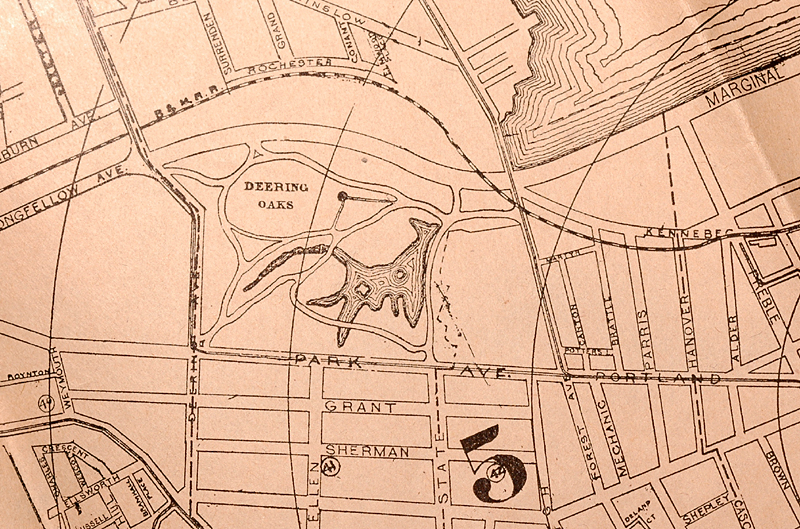
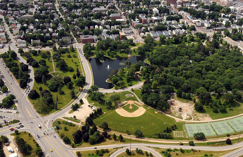 |
| Deering Oaks, with
the Rose Garden at Center left. The State St. extension is the road next to the pond. |
This is not true.
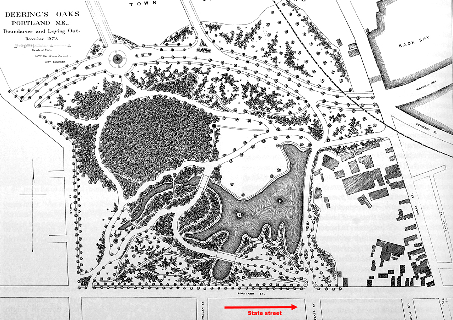
State Street was extended into the park about 1884, by the public in their horse-drawn carriages. This was done by rumbling over a drainage berm at the bottom of State Street to create a shortcut to the other side of the Oaks. This nascent road can be seen in the 1884 Thurston Company Map of Portland. This postdates the 1879 plan City Engineer William Goodwin drew up as a look at what the park could be.
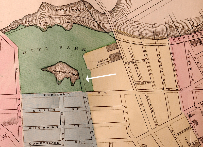
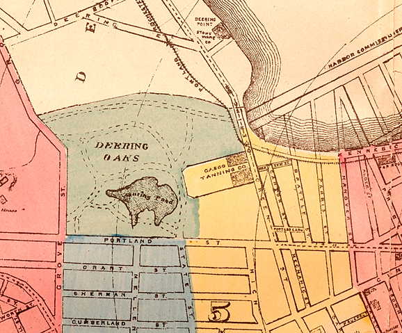
It cut closely by the Ricker Tannery, The Foyes Plow factory, the Reilly Foundry, a slaughter house, and a pork packing plant, among others. The northwest side of Deering Oaks (along Forest Avenue) was a foul, smelly industrial area, with many stinking cess pits. The odor in the area was incredible, according to contemporary reports.
Notice that the inlet from Back Bay extended into the
park. Marginal Way was Kennebec Street. By
1887 this was filled in, and
the current park roads system had been laid out. By
1917 the park was
looking like it does today. Green Street was renamed to Forest Avenue at
that time also. Marginal Way had gotten
more fill.
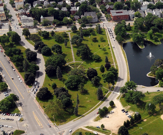
|
| The Rose Garden.
High St. comes down center left, Forest
Avenue is at far left |
contiguous businesses and went to a lot of trouble to clean up the industrial mess left behind, the current park boundaries were established.
The Rose Garden master plan was designed in 1927 by William Dougherty, parks engineer, and finally installed in its current location in 1933 by Karl Switzer, then parks superintendent. In the original 1927 master plan, the roadway can be seen at the top of the drawing.
The garden was never cut off at all- it was designed and placed in that location to
fill the space.
Stating that the cut-through was not meant for traffic flies in the face of the original 1886 design. In 1902 the road was widened to its current width to accommodate auto traffic, cars being wider than carriages. The new stone columns at the State Street entrance replaced the smaller ones installed in 1886.
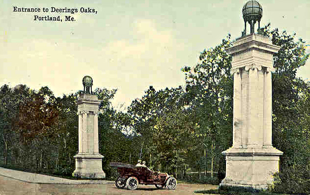 |
| An "Auto-mobilist" entering the park in 1910 |
“Reconnecting “ it has no merit- it was never connected in the first place. They are either lying, or don’t know what they are talking about. Ignorance doesn’t generate funding in most cases though, so we are left with lying.
The Friends own website at:
The Rose Garden Cutoff Myth has been created to get
money. It sounds better than reality.