SAP
Installation
Stevens Avenue Project : Installation
Just after the first two humps were installed in 1996 the DCNA had a small coffee-and-cookie gathering at Burbank library to celebrate the construction of the first two humps at Deering High and Longfellow. This meeting I actually found out about in advance, and went to. People there were very happy, smiling and cheery, very pleased with the results of their efforts.... at least until I started asking questions about the 6.5 second delay, the crossing problem, the traffic data, the nonexistent speeding problem, etc. They had no idea that the report stated what it did. They had not read it.
Paula Craighead, the hostess, said that perhaps they should have me come to any future meetings so they would be able to fine-tune their efforts and eliminate the trouble spots! I couldn't believe it, and left totally disgusted.
I continued to ask anybody I met over the next two years if they had read the report about the Stevens Ave. project . Nobody, other than Mr.'s. Gorrill and Hedricks, the engineers at DeLuca-Hoffman who wrote it, and myself, had ever read the report. NOBODY. I couldn't believe it; it was astounding. All those people, the Deering Center Neighborhood Association (DCNA), the city officials involved, the federal and state state officials involved, the construction officials involved, no-one had read it. This sounds unbelievable, but it is the case.
In talking to project supporters, I understood that they THOUGHT they knew what the report had said, but they actually did not. They were proceeding under mistaken circumstances. Worse yet, when their inaccuracies were pointed out to them, they would all just kind of shrug and smugly say "Well...WE think it needs to be done!" and continue on their merry way.
The whole project was based upon the erroneous ideas of the citizens involved, with city council complicity. The study refuted all of their conclusions and justifications for "calming" traffic on Stevens Avenue, and they didn't care. The project was going to continue no matter what the facts said. It was like trying to stop a glacier.
The two speed humps
applied to the street did not really change any of the traffic speed patterns, according
to the Longfellow crossing guard, Mr. Rench. It did make the proponents of the project
happy as their children were "safer" all of a sudden. They couldn’t
say how, but they felt that
way.
I soon heard about the plans to neck
down, chicane (road weave), and add more speed humps and tables to the avenue.
The more I tried to find a rationale for this whole mess the more I realized
that a small group of individuals, about 30, comprising the Deering Center
Neighborhood Association, were behind the project. They actually were the ONLY people who
WERE behind it in the neighborhood.
Stevens was widened in the 1960's because it was thought that making it wider would make it safer.
There have been two known deaths on the street in the Deering Center area, both non-school age children who ran out from between parked vehicles. The first was about 1950, when a boy ran out between parked cars, was hit by a semi in front of Longfellow school, and dragged down to Deering HS. The other was around 1975, when a 6-year-old ran out of Pats Meat Market up the street, between two parked cars and got hit by a DPW truck that was backing up.
Hump proponents have never explained how humps stop children from running into the road. They don't.
How it worked:
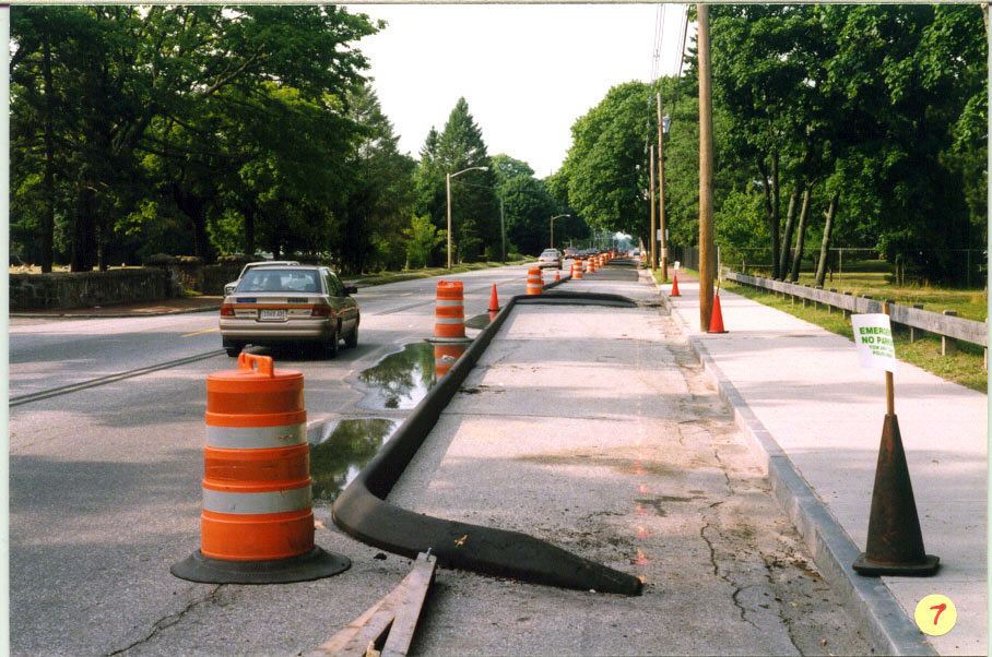
In July of 1997, asphalt curbing was applied to the street. Streets connecting to Stevens had bumpouts applied to the corners, rounding out into the street, and narrowing the street to about 1 1/2 cars width. Parking was eliminated in front of Longfellow where parents drop their children off for school, on both sides of the street.
The bumpouts decreased the distance that pedestrians had to cross to reattain the curb. They had to take 3 fewer steps. The Alliance for Transportation Choice thought it was better for pedestrians to be closer to traffic also.
(Click on images for larger view)
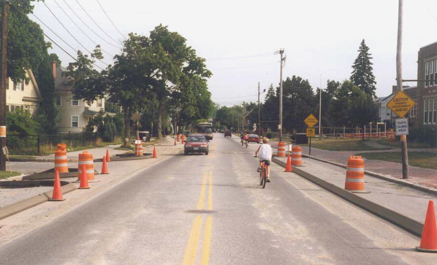 July
1997: Looking south in front of Longfellow, at Concord and Stevens. Shows
elimination of parking in front of school and bumpouts at intersection. The
space between the new curbing measures 26 feet. It was supposed to have a
5' bike lane, and a 12' travel lane on each side of the yellow
line (add it up!). Notice the boy on the bike, out in traffic, when he could be
over next to the curb, except for the new curbing!..........................
July
1997: Looking south in front of Longfellow, at Concord and Stevens. Shows
elimination of parking in front of school and bumpouts at intersection. The
space between the new curbing measures 26 feet. It was supposed to have a
5' bike lane, and a 12' travel lane on each side of the yellow
line (add it up!). Notice the boy on the bike, out in traffic, when he could be
over next to the curb, except for the new curbing!..........................
.
..................................................And 10 seconds later............................................
 ......there
is all kinds of traffic! It looks a little squeeeeeezy, to me! The space between
the car at right and the curb is about 18-24" wide, and is filled with
sand--notoriously slippery for bikes. That space is where bikers would have been
forced when traffic came along.
......there
is all kinds of traffic! It looks a little squeeeeeezy, to me! The space between
the car at right and the curb is about 18-24" wide, and is filled with
sand--notoriously slippery for bikes. That space is where bikers would have been
forced when traffic came along.
These pictures were shown to William Bray head of DPW, at the 808 Stevens Ave. meeting (see below). He declined to answer questions about the safety aspects of this situation.He did say that it would take "a few" accidents or deaths before the project would be removed. Those never got to happen, thankfully, because public outcry got the berms removed 3 weeks later.
It should be noted that one reason for this project was so that children “could ride their bikes to school”. Nice thought, except that Longfellow School policy of 25 years does not allow kids to do so, as the school does not want to be responsible for the bikes, or have them cluttering up the schoolyard. Nobody bothered to check this first.
The curbing in front of Longfellow narrowed the road from 43 feet to 26 feet eliminating the bike lane/parking area. Anyone riding past the school on a bike would be forced out into traffic.
The 26 foot width of the road was split down the middle by the yellow centerline, making each lane 13 feet wide. According to city officials, there was to be a 5-foot bike lane, and a 12-foot vehicle lane in this area on each side of the centerline. 5 feet plus 12 feet equals 17 feet. 17 feet plus 17 feet equals 26 feet, according to the city (see photos above).
The effect of this narrowing put everybody on a bike into a slippery sand and gravel- filled lane 2 feet wide, 1 foot from traffic. This allegedly was somehow an improvement over having the biker 8 feet from traffic. Remember that proponents originally contended that children were too close to traffic when 8 feet away, before the curbing was installed!
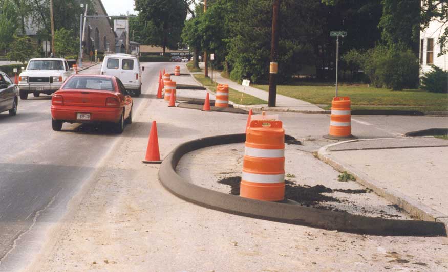
In Deering Center, Brentwood St. was bumped out, as were the other streets and driveways up to New Street. At New Street, the road made a zig across the road, with curbing extending out 12 feet from the curb, making the road about half its previous width all the way to Walton Street, where it zagged back to the original path. This eliminated all the parking for Catherine McCauley HS on the east side of Stevens.
 July,
1997: Bumpouts and parking elimination at Concord and Stevens, across from Longfellow School, looking north, just north of the speed
hump/crosswalk. These caused people with trailers to have to wait for long
periods, as they had to pull out into the opposing lane to make the corner.
Notice how the curbing touches the old curb, eliminating the bike lane, forcing
bikes out into the graveled area a foot from traffic.
July,
1997: Bumpouts and parking elimination at Concord and Stevens, across from Longfellow School, looking north, just north of the speed
hump/crosswalk. These caused people with trailers to have to wait for long
periods, as they had to pull out into the opposing lane to make the corner.
Notice how the curbing touches the old curb, eliminating the bike lane, forcing
bikes out into the graveled area a foot from traffic.
These features were alleged by supporters to be "beautifying" the street.
Further up Stevens, in the Arbor St. area, medians were built in the middle of the road, blocking entrance to a church parking lot. Cars had to go all the way to Morrill's corner, make a U-turn in a bakery outlet parking lot, and go back up the street. The medians also created bottlenecks in that if cars were parked legally in front of the businesses there, the road was too narrow for busses and fire trucks to get through. Fire trucks would come down the road, cars would pull over within the median area, and the truck would have to stop and “honk bump” the cars ahead to be able to continue. This was "safety".
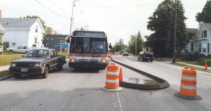
July 1997; bus tries
to pass truck parked
median area at the northern end of Stevens. The bus and
fire truck drivers really hated this situation. Sirens would make people stop
here with fire trucks behind them- the fire trucks would have to honk-bump the
cars forward, to be able to proceed. This situation drastically slowed fire
trucks; obvious to everyone but supporters of the project
Back at Longfellow School, the plan was to route all the busses and cars
away from the parking lane that no longer existed in front of the school by running them through the
parking lot at the end of the school. This would entail all the cars making a
left or right onto Pleasant St, going 50 feet, making another left onto West Concord,
going down that about 100 feet, left into the parking lot and around a loop that
is 75x100 feet in length (about the size of a tennis court) with two rows of
cars in the middle of the circle, and cars all around the perimeter.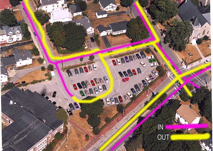
Parents would drop their kids, and then would exit out onto the street, if turning left, rejoining the cars lined up waiting to get into the parking lot, to exit into and through the neighborhood where there were more children walking to school, or, if going right, back to Pleasant St. where they would have to turn right or left into the one lane morning rush hour traffic. According to the Phase 1 report, this would be about 3 busses, and 174 cars in the morning, 110 in the afternoon, all within a 20 minute period. This was "safety"? This was nuts.
On the other side of Stevens, all cars would have to pull down Concord or Tremont and drop their kids, to have them cross the allegedly "dangerous" street. The parents would all then have to exit through the neighborhoods, again where hordes of kids are walking to school.
 |
Right: July, 1997: Remember, according to the
0riginal CMAQ funding
request from the city to the Federal Highway Administration, the project was to
"beautify the avenue", amongst other things. This
the view from opposite New St. looking
North. This chicane eliminated all the parking that Catherine McCauley HS used to have.
The "bike lane"
looks
a little rugged, no matter what side of the
curbing you
are on!
The point of the curb is about 18" from the original curbing- just
right to catch a pedal on!
Notice that the asphalt forces
bikes out closer to moving traffic-- more safety! These also wer supposed to be
filled in and planted with trees, etc., so the proposed bike lanes are science
fiction.

Left: Lincoln Middle School, looking North. Notice the hits on the curbing within hours of its installation.
 This
was cute: the median on the very north end of the avenue blocked off access to a
church there from the south. To get to the church if you were headed North, you had to go
about 400' further, and pull a U-turn, or circle in and out of a bakery store parking
lot. This is a high accident area without the curbing!
This
was cute: the median on the very north end of the avenue blocked off access to a
church there from the south. To get to the church if you were headed North, you had to go
about 400' further, and pull a U-turn, or circle in and out of a bakery store parking
lot. This is a high accident area without the curbing!
If you wanted to go North out of the driveway, you had to go about 200' South, and U-turn, or 3-point in a driveway!
People were not too happy about this. Ah, safety!
August 6, 1997: The crap comes off the road.
Just 3 weeks after it was
installed, the mess was taken off the road. Even the supporters of the project
thought the curbing was a disaster (especially since their neighbors roundly and
endlessly criticized it and the idiots who put it in!) and nobody was sad to see
it gone. It took about a day to get it off the road. You can see in the
pictures below, it just scraped right off.
After the illegal
meeting the Public Safety Commission had at Northgate they decided the
speed humps would be Phase II. Those wascally wascals in City Hall just
didn't get the picture.
The other story is that even with the
failure of the curbing, the Council steamed full speed ahead and installed 4
more humps and a speed table, all by the end of November 1997. Those humps are
still there as of March 2011. Some "experiment"!
The table under the signal at Pleasant and Stevens is the only one in the
United States. It's useless.
 |
 |
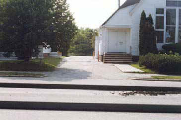
| At New St. and Stevens | With the median removed, traffic can move!
(to see what it looked like previously, click here) |
Next: to Public Concern
Back to : History