History
Stevens Avenue Traffic Calming Project: History
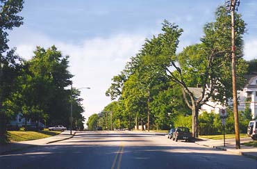 |
| Stevens Avenue, looking North from Deering Center |
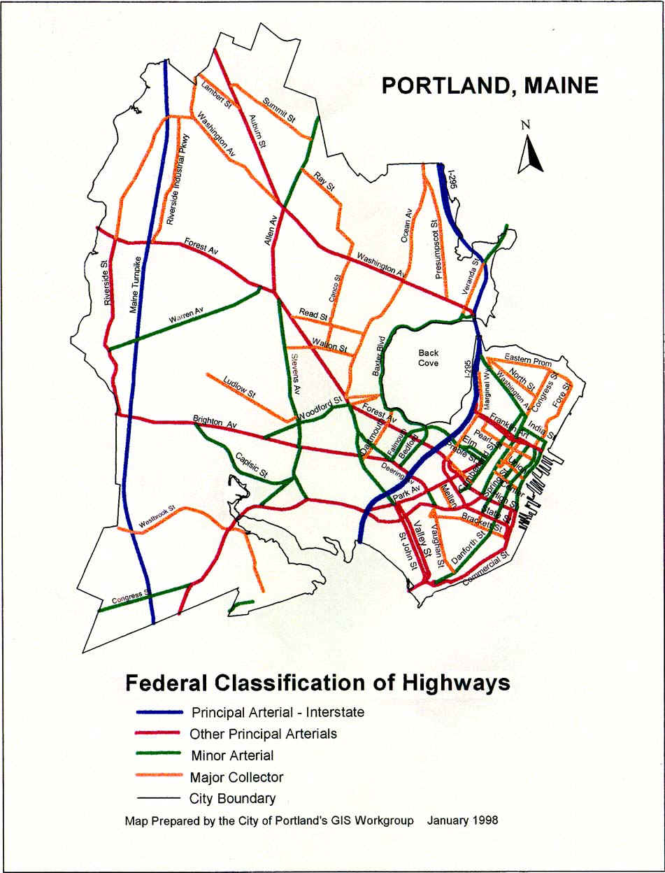
Stevens Avenue, Route 9, in the Deering Center section of Portland, Maine is one of the city's main thoroughfares, changed in 1993 (on paper) from a “major arterial” to "minor arterial". It connects the northeastern section of the city, in addition to parts of Falmouth and Cumberland, Maine, to the south and western sections of the city, where there is a heavy concentration of businesses and light industry. The Maine Mall, 1,200,000 square feet in size, is located 5 miles from the junction of Stevens and Congress along with many other smaller contiguous shopping areas. Congress St. is the only direct route to the Mall from the western side of Portland. CITY MAP
The avenue itself is about two miles in length, and stretches from Congress Street at its South end, to Forest Avenue in the North. Stevens, Congress, and Forest are all designated state routes, numbers 9, 22, and 302 respectively, and as such fall under the states jurisdiction for planning. The City of Portland is responsible maintenance and for plowing in the winter, but the state is allegedly responsible for speed limits, any construction on, or changes in the road.
It is 48 to 50 feet wide, having been widened in the 1960s from a standard width street. It was felt at that time that widening would make the avenue safer.
Stevens Avenue is unique in that it is the only known street in the US where one can go from kindergarten to college on the same street. There are two grade schools, a high school, a middle school, and a college all within a one-mile distance.
There are an average of 2500 students going to those schools each day of the school year. About 1,300 are under the age of 18.
It's worth pointing out right now that there have been no
occurrences of injury
or death to school or home-bound children
on Stevens in the last 65
years.
Actually, none
known, ever.
Project supporters ignore this fact.

The school at left is Deering High School, the one at right, Longfellow Elementary School.
The two speed humps in this area are directly out the front doors of the schools, and can be seen as perpendicular yellowish smudges on the road.
Paula Craighead lived on the the corner of Concord and Stevens (in the house above the white-roofed house in the row of three in the lower right corner).
ROAD CLASSIFICATION CHANGE
The Clean Air Act was passed in 1990, which, simply put, was a federally governed project to improve air quality in the U.S. through the use of regulations on industry and vehicles.
An offshoot of this was the Intermodal Surface Transportation Efficiency Act (ISTEA) of 1991, which authorized funding in all its various forms for the Clean Air Act. An offshoot of that was the Congestion Mitigation-Air Quality Act, funds of which were to be spent only on projects which would clean up the air.
In 1992, ISTEA mandated that all cities over 5,000 population define their urban area boundaries, and classify the streets and roads within those boundaries. This had to be done for construction funding purposes: ISTEA wanted to know just where cities were, and what types (sizes) of roads the cities had within their boundaries.
At that time Stevens Avenue was on a short list of 10 roads that had been sent from Portland to the state for inclusion as a “major arterial” of the city. It had been on that list since 1988.
On Feb. 11, 1993, John Duncan, head of PACTS, sent a letter to the PACTS Technical Committee stating that they might have to have a "special meeting" about roads classification policy before the usual Policy Committee meeting on Feb. 25.
On March 9, 1993, a Technical Committee meeting was held where William Bray recommended that the 1988 list of arterials be adopted by the Policy Committee, except for Stevens Avenue. He said he wanted it "kept" as a minor arterial.
Note that "kept" implies that the road already was a minor arterial. It also allows the covert changing of the roads status by use of terminology. It's all in how one is aware of the original circumstances, versus what someone wants to do to change a perception .
Enter Paula Craighead, the inceptor of the Stevens Avenue
Traffic Calming Project. She had some problems with the traffic outside
her house, which was located at the corner of Concord and Stevens across
from Longfellow school.
PROJECT INCEPTION; PAULA CRAIGHEAD

Paula lived on the corner of Stevens Avenue and Concord Street (she moved out of Portland in June 1999). Her initial contention in February 1992 in a letter to then DPW head George Flaherty was that accidents were occurring because traffic was going too slowly. (1) That contention was for some reason changed by Portland DPW within a year, to improper speeding causing accidents.
Allegedly, she was home one day at her house when she heard squealing tires and a "crunch" from the street. A car had stopped short when a crossing guard at the school stepped into the street to cross a child, and the car behind the first rear-ended it, pushing it into the crosswalk. After researching the cause of the noise, she decided that Stevens Ave. was unsafe, and started a campaign to slow the traffic on the street to levels she thought would be safe (The dichotomy of her thinking that traffic was going too slowly, thereby causing accidents, then too quickly, which then had to be slowed to the previous accident-causing speed, somehow making the previous dangerous slow-speed situation now safe, has never been explained. If you think this is confusing, welcome to the club).
Ms. Craighead somehow found out that under federal guidelines speed humps should not be applied to “major arterials". She managed to gain a position on the Portland Area Comprehensive Transportation Survey (PACTS) committee that was classifying Portland streets. She was the only “civilian” on the committee, made up of a number of urban planning and engineering professionals. Shortly after her arrival at PACTS, Stevens Avenue was downgraded to “minor arterial”, which allowed humps to be applied to it under federal guidelines by stretching the rules and regulations a bit.
Stevens Avenue meets all the criteria for a “major” listing under the federal classification system, as put forth in the American Association of State Highway Offices (AASHTO) “Greenbook”, considered nationally to be THE compendium for road classification requirements. 3,000 vehicles a day on a road makes it a major arterial. Stevens was carrying 16,500. It's a major arterial.
Just how Stevens’ classification was degraded is yet to be
determined. As seen above, it was taken off the list of streets Portland was
asking the state to consider as “major arterials”. Why all those
professionals at PACTS went along with it is another question. Politics,
maybe?
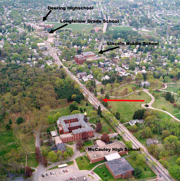
Aerial view of Stevens from just
north of Walton St.
McAuley High School is at the bottom, Lincoln Middle School is the first
large brick building in the other side of the street, with Longfellow
and Deering High in the upper left corner.
The "crosswalk to nowhere" (speed hump) can be seen as a yellow smudge at the red arrow (click on picture for larger view)
Paula was at the time a recently failed candidate for City Council, and the current head of the Deering Center Neighborhood Association (DCNA), an ad hoc group of people who got together to “improve” Deering. (She once came up with the idea of petitioning the city to build 2-foot-high, 2-foot-wide brick planters continuously along both sides of Stevens Ave, from Ludlow Street to beyond Westbrook College [about a mile in length], as part of a Deering Center "beautification effort". Reception to this idea was rather tepid at best, even among the members of the DCNA, and she dropped it (add water and you'd have a canal! ).
Paula was at one time head of the Democratic Committee in
Portland, and also on the school board for many years with her friend
Charles Harlow, a teacher at Chevrus High School.
He later become a Democratic member of the Portland City Council,
and once there, head of the Public Safety Committee.
She got the DCNA together with the city council in 1993, and
together they petitioned the city to do a
study of Stevens Ave,
which the city did,
at a cost of $55,000. The engineering firm of DeLuca-Hoffman Associates,
Inc., of South Portland did the study. The DCNA also met during this time with members of the Maine
Department of Transportation to express their concerns about the traffic
on Stevens Avenue.
Thus, in 1992 she was involved with the aforementioned roads classification
committee at PACTS, working to downgrade Stevens from a major to minor
arterial so it could be humped. She also started the
"Stevens
Avenue Advisory Committee" to help the city with its efforts to get her
plan on the road. She went to a lot of meetings.
(PACTS Letter)
The neighborhood meetings were open to the public, and allegedly advertised. I had asked to be put on the list for notification of meetings, but somehow never got one. I would hear about them days later when various people would ask me where I had been (Michael Cuddy, a DCNA member, comes to mind).
Some people did find out about them, and actually did go, only to feel less than welcome. The owner of Pompeos Pizza, a pizza place in the heart of Deering Center, left very angry one night according to his son, as he was getting laughed at by the members of the DCNA for expressing his view that there was nothing wrong with the street. Peter Scarpaci, a resident on Leonard St. also attended another meeting and left feeling badly for the same reason.
Bruce Ibarguen, the state traffic engineer assigned to help the DCNA told me that he had never seen meetings that flowed so smoothly. No-one at the meetings ever had anything negative to say about any of the changes being planned for the avenue, which he found unique in his experience.
The study didn't actually say that there was a speeding problem. What it said was that "speeds seem high", and that there was a "perception" of speeding.
Be that as it may, The study was released, ambiguous as it was. Work commenced in the Fall of 1996 with the installation of two speed humps on Stevens, one in front of Longfellow school, the other just south of Walton Street, by Catherine McCauley High School.
The one at Longfellow had a crosswalk painted on the top of it. This is nothing more than a speed hump with a cross walk on top, but it “raises” the “value” of the hump to a “raised crosswalk”, which is supposedly safer than an unraised crosswalk. How an increase in elevation of 2-3 inches makes pedestrians safer has never been explained. Tall people must be "safer" than short people, by this rationale.
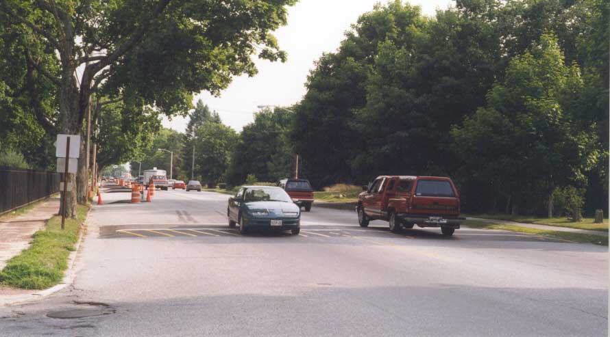 Walton St. and Stevens,
July 1977, at one end of the chicane (road weave). Walton can be seen
curving off to the left in the lower left corner. This hump was
way out
of guideline compliance, being located too close to an intersection. Notice the
long skid marks behind the car at left. They are very common on both
sides of the humps, as people suddenly realize that the car in front of
them has slowed to a crawl. Accidents went up 40% after the humps went
in.
A traffic light
was later installed at this intersection, and the hump removed.
(click on image for larger view)
Walton St. and Stevens,
July 1977, at one end of the chicane (road weave). Walton can be seen
curving off to the left in the lower left corner. This hump was
way out
of guideline compliance, being located too close to an intersection. Notice the
long skid marks behind the car at left. They are very common on both
sides of the humps, as people suddenly realize that the car in front of
them has slowed to a crawl. Accidents went up 40% after the humps went
in.
A traffic light
was later installed at this intersection, and the hump removed.
(click on image for larger view)
Next to: Installation
(1) Also in : PACTS Phase 1 Technical Supplement-Stevens Avenue Pedestrian Study, Data Collection and Problem Identification; Appendix B, “Project Correspondence”; letter of Feb. 5, 1992, page 1, paragraph 9.
Top